The Mississippi River is the second-longest river in the United States and it is the fifth largest river in the world by its volume. This river has a length of 2,320 miles, 3,730 km from its source in Lake Itasca in Minnesota to its mouth in the Gulf of Mexico.

Upper Mississippi River
The upper course of the river is always the source of the river. This is where the river begins. Many smaller streams and channels join up to form larger streams. Several streams join up to form a river. The upper course have deep, narrow, steep-sided, steeper gradient, V-shaped valley.


Lower Mississippi River
Meanders are common at the lower course of the river. There are many distributaries at this course. River flows towards its mouth and enters the sea. Delta is form at the river mouth. The lower course has shallow-channeled, flat-floored, very gentle to almost flat gradient and very wide almost U-shaped valley.

The Mississippi River is part of the Missouri-Mississippi river system, which is the largest river system in North America. It is also among the largest in the world with a length of 3,900 miles, 6,300 km. It is the fourth longest, and by its average discharge of 572,000 cu ft/s (16,200 m³/s), it is the tenth largest in North America.
Upper Mississippi River
The upper course of the river is always the source of the river. This is where the river begins. Many smaller streams and channels join up to form larger streams. Several streams join up to form a river. The upper course have deep, narrow, steep-sided, steeper gradient, V-shaped valley.
The upper Mississippi River is divided into three sections:
- The headwaters with a length of 493 miles, 793 km; from the source to Saint Anthony Falls
- A series of man-made lakes between Minneapolis and St. Louis, Missouri with a length of 664 miles , 1,069 km
- The middle Mississippi with a length of 190 miles, 310 km, a relatively free-flowing river downstream of the confluence with the Missouri River at St. Louis.
Source
The source of a river is the place from which the water in the river originates. The source of the Mississippi River is Lake Itasca. It is 1,475 feet, 450 m above sea level in Itasca State Park located in Clearwater County, Minnesota.
The uppermost lock and dam on the Mississippi River is the Upper St. Anthony Falls. Above the dam, the river's elevation is 799 feet (244 m). Below the dam, the river's elevation is 750 feet (230 m). This 49-foot (15 m) drop is the largest of all the Mississippi River locks and dams. By the time the river reaches St. Paul, Minnesota, below Lock and Dam, it has dropped more than half its original elevation and is 687 feet (209 m) above sea level. From St. Paul to St. Louis Missouri the river elevation falls much more slowly and is controlled and managed as a series of pools created by 26 locks and dams. From St. Louis to the Ohio River confluence the Mississippi free falls a total of 220 feet (67 m) over a distance of 180 miles (290 km) for an average rate of 1.2 feet per mile (23 cm/km). At the Ohio River confluence the Mississippi is 315 feet (96 m) above sea level.
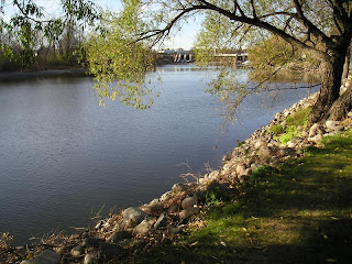
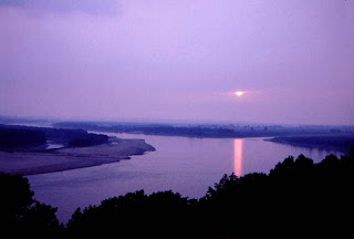
Lower Mississippi River
Meanders are common at the lower course of the river. There are many distributaries at this course. River flows towards its mouth and enters the sea. Delta is form at the river mouth. The lower course has shallow-channeled, flat-floored, very gentle to almost flat gradient and very wide almost U-shaped valley.
Major sub-tributaries include the Tennessee River and the Platte River. The Arkansas River joins the Mississippi in southeastern Arkansas. The Yazoo River meets the Mississippi at Vicksburg. The Atchafalaya River in Louisiana is major distributaries of the Mississippi.
Mouth
The mouth of a river is where it meets the ocean. At the mouth of the Mississippi river, it discharges at an annual average rate of between 200,000 and 700,000 cubic feet per second and releases about 400 million yards of mud, sand, and gravel per year.
Although it is the fifth-largest river in the world by volume, this flow is a mere fraction of the output of the Amazon, which moves nearly 7 million cubic feet per second during wet seasons. On average the Mississippi has only one-eleventh the flow of the Amazon River, but is nearly twice that of the Columbia River and almost six times the volume of the Colorado River.

No comments:
Post a Comment